Wednesday, 29 June 2011

Kegon Falls

This postcard came to me from Japan.

Kegon Fallus are located at Lake Chūzenji - (source of the Oshiri River) in Nikkō National Park in the city of Nikkō, Tochigi Prefecture, Japan. The falls were formed when the Daiya River was rerouted by lava flows. About twelve smaller waterfalls are situated behind and to the sides of Kegon Falls, leaking through the many cracks between the mountain and the lava flows.

There are 48 waterfalls in Nikko, but Kegon waterfall is the most famous among these. The water falls from 97 meters high and you will enjoy natural beauty around the fall. Nachi waterfall in Wakayama prefecture, Fukuroda waterfall in Ibaragi prefecture and Kegon waterfall in Nikko are known as the finest three waterfalls of Japan. The name of the Kegon was derived from a part of Buddhist sutra. By the way, names of Nehan waterfall and Hannya waterfall also were derived from the Buddhist sutra.

In the autumn, the traffic on the road from Nikko to Chūzenji can sometimes slow to a crawl as visitors come to see the fall colors.

The Kegon Falls are infamous for suicides, especially among Japanese youth.

Apple trees :)

I don't know from who Yuliya knew that I love apples :) 
She sent me a postcard with apples trees orchard :) Yuliya lives in Saratov which is situated on the right bank at beautiful Volga river. 

Белавежская пушча - Belovezhskaya Pushcha

The Belovezhskaya Pushcha (Białowieża Forest), is an ancient woodland straddling the border between the two countries, located 70 km north of Brest - Belarus and 62 km south-east of Białystok - Poland. It is one of the last and largest remaining parts of the immenseprimeval forest which once spread across the European Plain.

Bialowieski Forest - the jewel of both European and world-wide lowland forests: wild, primeval, with a unique rhythm of phenomenal nature, captivating and enthralling, one of a kind, the only one preserved in such an extraordinary form.

The Białowieska or Białowięza Forest on the Polish side (as opposed to the Belovezhskaya Forest on the Belarussian) is located between longitudes 23°31' and 24°21' E and between 52°29' and 52°57' N. It lies along some kind of boundary zone between Western and Eastern Europe and is not far from the very extensive complex of marshlands of Polesie. The Forest (termed a Primaeval Forest or Puszcza in Polish) extends 55 km from east to west and 51 km from north to south. The Białowieski (Białowieża) National Park in turn occupies the Forest’s central part, its eastern limits being delineated by the Polish-Belarussian state border. The western limits are provided by the route of the old forest railway, and hence the boundary with the forests in the Forest Districts of Białowieża and Browsk. To the north there lies Browsk FD once again, as well as the land in Masiewo village. The southern limits of BNP are in turn set by Polana Białowieska, i.e. the Białowieża Clearing (in which the village of Białowieża is located), as well as the Browsk Road.

In turn, in line with the division into Natural-Forest Regions arrived at by the Forest Research Institute, the area in question is within the Second (Mazury-Podlasie) Natural-Forest Region, and more specifically its Białowieża Forest District.

As noted above, the Forest straddles a state border, with the 870 km2 eastern part located on Belarussian territory. The Western (Polish) part is smaller, at around 632 km2. The part in Belarus (formerly the Byelorussian SSR) originally enjoyed the status of Zapovednik or Reserve, before being transformed in 1957 into a State Hunting and Reserve Holding. It in turn had the status of State National Park conferred upon it in September 1991.

The National Park is situated in the north-east part of Poland, in podlaskie voivodeship. The Park covers the central part of Białowieża Forest.

The Park covers the area of 10 517,27 ha, which constitutes 1/6 of the Polish part of Białowieża Forest. 5725,75 ha is under strict protection, 4438,20 ha is under active protection, and landscape protection covers the area of 353,32 ha. There has been a protection zone created around the Park which covers the state commercial forest having an area of 3224,26 ha.

The park comprises 3 administrative units: Orłówka Protective Unit, Hwoźna Protective Unit and the European Bison Breeding Center (covering three breeding reserves and European Bison Show Reserve). 
Białowieża National Park protects the best preserved fragment of Białowieża Forest – last natural forest at the European Lowland Area, having the primaeval character, identical with the one which covered the area of deciduous and coniferous forests years ago. The characteristic feature of the park is its biological diversity. The Park comprises, inter alia, 809 vascular plants species, over 3 thousand cryptogams and fungi species, almost 200 moss species and 283 lichen species. There have been more than 8 thousand invertebrates species, approximately 120 species of breeding birds and 52 mammal species. Old, primaeval forest stands in Białowieża National Park are characterized by large amounts of  deadwood at the various stage of disintegration, and by the presence of typical natural forest species. Among the birds to be fund in the park one can identify e.g.: Eurasian pygmy-owl, three-toed and white-backed woodpecker; the beetles – black fir sawyer, Osmoderma eremita, Pytho kolwensis; and the butterflies  – Aglia Tau, moorland clouded yellow.  
Apart from Białowieża Forest, many of the aforementioned species can be identified only in few places worldwide.

European bison (from wikipedia)
European bison – the biggest European land mammal – is the symbol of the Park. Białowieża Forest became last mainstay for the lowland European bison. The process of its reinstatement, bringing it back to nature started right there. At present, Białowieża Forest comprises the largest free-living population of European bison in the world. There are approximately 450 European bison living in the Polish part of Białowieża Forest

Białowieża National Park is the only Polish natural property designated by UNESCO as a World Heritage site. The Park is the most important – central zone of Białowieża Forest Biosphere Reserve.


Tuesday, 28 June 2011

Montenegro

This postcard I received from Ola - my wonderful friend from Poland. She spent on Montenegro a few days for relax and....she remember that I like to receive a postcard so...she sent to me one :) Thank you Ola :) 

Herceg Novi is a coastal town in Montenegro located at the entrance to the Bay of Kotor and at the foot of Mount Orjen. It is the administrative center of the Herceg Novi Municipality with around 33,000 inhabitants. Herceg Novi was known as Castelnuovo ("New castle" in Italian) (1420 - 1797). Herceg Novi has had a turbulent past, despite being one of the youngest settlements on the Adriatic. A history of varied occupations has created a blend of diverse and picturesque architectural style in the city.

Herceg Novi is a town at the entrance of the Boka Kotorska Gulf. Mild Mediterranean climate, crystal clear sea water, long beaches, rich flora and fauna, are the reasons having an unforgettable vacation at the Herceg Novi Riviera.
Herceg Novi is still decorated by several fortresses from the Turquish, Venetian, Spanish and Austrian periods.
Herceg Novi has a specific microclimate, which is a result of southern exposition, proximity to the sea, limestone substratum and mountainous hinterland which prevents the breakthrough of cold air masses. Rare examples of flowers and decorative trees are cultivated there.

Belarus


This is my another official card from Belarus. I have got it from Anastasia. She was born in Belarus, however now she lives in  Minsk - capital. 


While archeological evidence points to settlement in today's Belarus at least 10,000 years ago, recorded history begins with settlement by Baltic and Slavic tribes in the early centuries A.D. With distinctive features by the ninth century, the emerging Belarusian state was then absorbed by Kievan Rus' in the ninth century. Belarus was later an integral part of what was called Litva, which included today's Belarus as well as today's Lithuania. Belarus was the birthplace of the Grand Duchy of Lithuania. Belarusian was the state language of the Grand Duchy until 1697, in part owing to the strong flowering of Belarusian culture during the Renaissance through the works of leading Belarusian humanists such as Frantzisk Skaryna. Belarus was the site of the Union of Brest in 1597, which created the Greek Catholic Church, for long the majority church in Belarus until suppressed by the Russian empire, and the birthplace of Thaddeus Kosciuszko, who played a key role in the American Revolution. Occupied by the Russian empire from the end of the 18th century until 1918, Belarus declared its short-lived National Republic on March 25, 1918, only to be forcibly absorbed by the Bolsheviks into what became the Soviet Union (U.S.S.R.). Suffering devastating population losses under Soviet leader Josef Stalin and the German Nazi occupation, including mass executions of 800,000 Jews, Belarus was retaken by the Soviets in 1944. It declared its sovereignty on July 27, 1990, and independence from the Soviet Union on August 25, 1991. It has been run by authoritarian Alyaksandr Lukashenka since 1994. (from here)

Anastasia told me that Belarus is named "country with blue eyes", becasue there are many lakes and rivers. She told that there are more than 11.000 lakes. 

Thursday, 23 June 2011

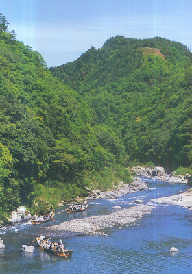
Storm Mountain - Arashiyama

This time I will show you my postcards which I found in the envelop with the letter which came to me from Japan.

Arashiyama is a district on the western outskirts of Kyoto (Japan). It also refers to the mountain across the Ōi River, which forms a backdrop to the district.
Hozu River - Shooting the Rapids

The Hozu River is a part of Katsura River in Kyoto Prefecture. The river begins in the mountains near Kameoka, a town northwest of Kyoto City. It snakes into the Arashiyama section of western Kyoto before changing its name to Katsura River.
The Hozu River is considered scenic, and is known primarily for its association with Hozugawa Kudari, literally “down the Hozu river”, a sightseeing whitewater boat that goes downstream from Kameoka to Arashiyama. Hozugawa Kudari is especially popular in the fall, when the Japanese Maple leaves change colors, and in the Spring, when the sakura, or Japanese cherry tree, blooms. The trip usually takes about two hours.

The Togetsukyō - bridge in Autumn


The Togetsukyō is a bridge across the river. The river shown in the photograph changes names on either side of this bridge. West of the bridge it is the Hozu River and east of the bridge it is the Katsura River. It is the symbol of Arashiyama area, the beautiful sight of this bridge has been taken up by many a poet. In days of antiquity, boating here was an eloquent pastime for the aristocracy. 

Tuesday, 21 June 2011

国立中正纪念堂 - Chiang Kai-shek Memorial Hall

The Republic of China, commonly known as „Taiwan”, is a state located in East Asia. The Republic of China - ROC - governs the island of Taiwan, which forms 99% of its current territory, as well as Penghu, Kinmen, Matsu and other minor islands. It is the oldest surviving republic in East Asia. Neighboring states include the People’s Republic of China - PRC, 160 km to the west, Japan to the northeast, and the Philippines to the south. Its capital city is Taipei

The National Chiang Kai-shek Memorial Hall is a famous monument erected in memory of Chiang Kai-shek, former President of the Republic of China. It is located in Taipei, Republic of China (Taiwan).Chiang Kai-shek (October 31, 1887 – April 5, 1975) was a political and military leader of XX century China. He is known as Jiǎng Jièshí or Jiǎng Zhōngzhèng in Mandarin.

The monument, surrounded by a park, stands at the east end of Memorial Hall Square. The structure is framed on the north and south by the National Theater and National Concert Hall. The entire plaza is located within sight of the Presidential Office Building.

Memorial Hall is white with four sides. The octagonal roof rises 76 metres above the ground and is covered with blue glazed tiles. The blue and white colors of the building and the red colour of the flowerbeds echo the colours in the flag of the Republic of China. The octagonal shape picks up the symbolism of the number 8, a number traditionally associated in Asia with abundance and good fortune.

The construction site occupies an area of 250,000 square meters. In addition to the Chiang Kai-shek Memorial Hall, the National Opera House, and the National Concert Hall were built on the same site. The construction of the Hall fell into two phases. During the first phase, the main body of the Hall, gardens, pavilions, verandah, and other related sites were built. For the second phase, the National Opera House, National Concert Hall, and an underground parking lot were completed in 1987.
The underlying concepts of the design:
1. To express the spirit of Chinese culture
2. An innovative design in a unique and grand style
3. The utilization of modern construction technology, with emphasis on economy and practical use. The color of the blue sky and white sun symbolize freedom and equality.

Two sets of white stairs, each with 89 steps to represent Chiang’s age at the time of his death, lead to the main entrance. The main entrance features a pair of double doors, each standing 16 meters high and weighing 75 tons, that open into the main hall. A large bronze statue of Chiang Kai-shek dominates the main hall. The figure is shown smiling, seated and wearing traditional Chinese dress. Inscribed on the wall above and behind the seated figure are the Chinese characters for “Ethics, Democracy, and Science”. Inscriptions on the side walls read “The purpose of life is to improve the general life of humanity” and “The meaning of life is to create and sustain subsequent lives in the universe”. An elaborate caisson is set into the ceiling, decorated with the emblem of the Kuomintang. Representatives of the armed forces guard the main hall during its open hours. The branch of service represented changes periodically according to a rotating schedule.
The ground level of the memorial houses a library and museum documenting Chiang Kai-shek's life and career and exhibits related to Taiwan's history and development.

The Memorial Hall is built upon three stories of broad and solid foundations that symbolize „Jhung Jheng” (impartial and righteous). The octagonal roof design creates many „ren” (Man), motifs on the very top, symbolizing the “unification of Man and Heaven.” The roof is fashioned in the form of the Altar to Heaven and covered with blue glazed tiles, reflecting the sunlight. The apex of the roof is gold in color and culminates the upsurge glory None of the other materials, such as the white marble, red cypress ceiling, and light red granite floor, have been tinted with artificial colors,thereby imparting a feeling of sacredness, solemnity, hospitality, and peace.

This postcard traveled to me for 46 days. It comes from Taiwan, and it was sent by Yi-Jheng Li. 

Friday, 17 June 2011

Terveiset Hauholta

I have got this postcard from Finland. The sender - Eeve - is a post-woman :) 
On the postcard you can see 3 pictures by Anne Suomela. She is Finnish photographer. 

On the photos we can find some views from south part of Finland. 
This card needs only 4 days to travel from Finland to Poland :) 

Wednesday, 15 June 2011

Symbol of youths dreams

I have got the postcard from Russia - another card which is official postcrossing card:) This time the sender - Victoria - lives on St. Petersburg.

On the postcard we can not find nothing about  this wonderful city, but....we can see a symbol of youths dreams :)
The Scarlet Sails festival on the Neva is held approximately five years. On the 18th of June graduates from School with parents, friends and teachers come to the centre of the city and party all night :). The symbol of the youths dreams is...the ship with scarlet sails.

This festive  is the most massive and famous public event in St. Petersburg. Its title has originated from a romantic novel with the same name (1922) by Alexander Grin – the book, known practically to every Russian. Two main characters of this touching story are a young lady Assol, seeing in her dreams a captain, who one day will arrive to her sailing a ship with scarlet sails and the captain Gray, who had heard about Assol’s best wish and made it come true. When at school each of us associated him/herself with these charming persons.

Now everyone can see this fairy tale – a ship with the scarlet sails – which is the unforgettable event in the lives of St. Petersburg high school graduates, who celebrate their leaving high school with farewell parties.
This celebration was originally introduced in 1968 and was arranged for 10 years in succession, followed by a long break of having no this festivity and only in 2005 it was renewed.
Now the “Scarlet Sails” is a large-scale show, gathering thousands of spectators not only from Russia, but also from all over the world.


As you can see, this postcard travelled big distance and appeared in my mailbox quite fast:)

Sunday, 12 June 2011

31st state of America

I have got this postcard from my pen-friend from California. Thank you La Shanna :) 

California is a state located on the West Coast of the United States. It is by far the most populous U.S. state, and the third-largest by land area. It is home to the nation’s second- and sixth-largest census statistical areas (Los Angeles Metropolitan Area and San Francisco Bay Area), and eight of the nation’s 50 most populous cities (Los Angeles, San Diego, San Jose, San Francisco, Fresno, Sacramento, Long Beach and Oakland). The capital city is Sacramento.

California is a place name used by three North American states: in the United States by the state of California, and in Mexico by the states of Baja California and Baja California Sur. Collectively, these three areas constitute the region formerly referred to as Las Californias. The name California is shared by many other places in other parts of the world whose names derive from the original.

Several origins have been suggested for the word “California”, including Spanish, Latin, South Asian, and Aboriginal American origins. All of these are disputed. California, called the Las Californias Province of the Viceroyalty of New Spain, originally referred to the entire region composed of the Baja California peninsula now known as Mexican Baja California and Baja California Sur, and upper mainland now known as the U.S. states of California and parts of Nevada, Utah, Arizona, and Wyoming. After Mexico's independence from Spain, the upper territory became the Alta California province. In even earlier times, the boundaries of the Sea of Cortez and the Pacific Ocean coastlines were only partially explored and California was shown on early maps as an island. The Sea of Cortez is also known as the Gulf of California. 

Beginning in the late XVIII, the area known as Alta California, comprising the California territory north of the Baja Peninsula, was colonized by the Spanish Empire as part of New Spain. In 1821, Alta California became a part of Mexico following its successful war for independence. Shortly after the beginning of the Mexican-American War in 1846, a group of American settlers in Sonoma declared an independent California Republic in Alta California. Though its existence was short-lived, its flag became the precursor for California's current state flag. American victory in the war led to the Treaty of Guadalupe Hidalgo, in which Mexico ceded Alta California to the United States. Western areas of Alta California became the state of California, which was admitted as the 31st state on September 9, 1850 (from here). 

The postcard displays: wonderful beaches of LA to state capital building in Sacramento. First picture is from Yosemite National Park (it is a United States National Park spanning eastern portions of Tuolumne, Mariposa and Madera counties in east central California, United States. The park covers an area of
3 080,74 km
2 and reaches across the western slopes of the Sierra Nevada mountain chain. Over 3,7 million people visit Yosemite each year: most spend their time in the 18 km2 of Yosemite Valley. Designated a World Heritage Site in 1984, Yosemite is internationally recognized for its spectacular granite cliffs, waterfalls, clear streams, Giant Sequoia groves, and biological. Almost 95% of the park is designated wilderness) - from here

The last picture is of the iconic Golden Gate Bridge in San Francisco (it is a suspension bridge spanning the Golden Gate, the opening of the San Francisco Bay into the Pacific Ocean. As part of both U.S. Route 101 and California State Route 1, the structure links the city of San Francisco on the northern tip of the San Francisco Peninsula to Marin County. The Golden Gate Bridge was the longest suspension bridge span in the world when it was completed in 1937, and has become one of the most internationally recognized symbols of San Francisco, California, and of the United States. Despite its span length being surpassed by eight other bridges since its completion, it still has the second longest suspension bridge main span in the United States, after the Verrazano-Narrows Bridge in New York City. It has been declared one of the modern Wonders of the World by the American Society of Civil Engineers) - from here

The motto of California is: Eureka ("I have found it")

Thursday, 9 June 2011

Gift from my penfriend

This is another card from Czech Republic. However this postcard I have got from my great pen friend - Petra :) She sent me a postcard with the view which she sees every day :) I always want to live in this kind place :) It is a pity that we have not this kind houses and atmosphere on Polish city - or we have not that places there where I live.
   

The town of Velké Opatovice is situated in the middle part of Malá Haná, in so called Boskovice's furrow, below 50th parallel of the latitude.The local climate is mild, the lowest elevation is 388 metres above sea level, Hradisko, local highest hill, us 513 metres above sea level. (from here)

The first evidence of the settlement dates to 1308, when a contract shows the purchase of a town called Opatovice by the nearby Cimburk castle, today a ruin. 

The 'Velké' part of the name (meaning "great") was added in 1888, and the town became a city in 1969. 
The most significant estates in Velké Opatovice are those of the Vězník, Salm, and Herberštein families.
First written notes go back to 1308 when at a neighbouring castle Cimburk (ruined nowadays) was a buying contract concluded which concemed the purchase of Opatovice. Originally, Opatovice consisted of two independent parts - Horní and Dolní (Lower and Upper). Both parts developed independently till the 19th century. Since 1888 Opatovice has been called Velké Opatovice. The most important noble families who have resided at Opatovice are Věžník, Salm and Herberstein.

On 15th October 1969 Velké Opatovice obtained the status of the city.

In Velké Opatovice we can find also Cartographic Center. The centre hosts a permanent exhibition on the historical development of cartography. Subjects include the philosophy entailed in imagery of the Earth's surface on maps, and the history of the production of maps. The main auditorium displays a giant relief-map of historical Moravia and Silesia.

Monday, 6 June 2011

Southport

It is another postcard which I have got from my wonderful English pen-friend. Thank you for it. You made that day better in that moment :)

Southport is a seaside town within the Metropolitan Borough of Sefton, in Merseyside, England. During the 2001 Southport had a population of 91 404, making it the twelfth most populous settlement in North West England. This city is a traditional Victorian seaside town – but with a contemporary twist. It combines beautiful beaches, family attractions and the UK’s oldest iron pier with fantastic shopping, a superb choice of restaurants, world-class golf and a choice of accommodation from 4-star hotels to boutique guesthouses.

A popular story about the naming of the town, claims that Dr Miles Barton of Ormskirk named the area Southport when he was invited to a party by the founder of the town, William Sutton. The party was a celebration for the success of Mr. Sutton s venture. After good fare and enough drink, Dr Barton stood up to make a toast, referring to the hamlet as „South...” Having forgotten where he was and still focused on his glass of port, it was "...Port" that he finished with. „South Hawes" would have been the correct name at the time, but "South Port" took hold, with the latter name appearing in written records as early as 1798 (from here). 

On this postcard you can see Promenade and Floral Hall, Wayfarers Arcade, Fountain Statue, Botanic Gardens, Town Garden and Town Hall on Southport

Troll

Now will be a funny postcard :) I received this postcard from my wonderful pen-friend from Norway. Thank you a lot my dear Elin for a wonderful postcard :)

Here you are...Troll :)

If you do not know who is a Troll...please take a sit and read:
In Norse mythology, a troll is a generally negative synonym for jötunn. Later, in Scandinavian folklore, trolls became beings in their own right. In modern times trolls are depicted in a variety of media.
In Norse mythology, troll, like thurs is a term applied to jötnar. In Old Norse sources, trolls are said to dwell in isolated mountains, rocks, and caves, sometimes live together (usually as father-and-daughter or mother-and-son), and are rarely described as helpful or friendly.

The Trolls would come out from their hiding-places only after sunset, and they would disappear before sunrise. Direct exposure to the sun would cause them to crack, turn into stone and possibly burst. On occasion the Trolls would evidently forget to hide from the sun, and rock formations can today be found in various places with troll like features.

The trolls were mostly seen on bright moonlit nights, or during nights, or during stormy nights that could frighten about anyone who happened to be outdoors at that time. The trolls had very distinct features. They had long crooked noses, only four fingers and toes on each limb, and most of them had long bushy tails.
Some trolls were giants, and others were small. There were stories of two-headed as well as three-headed trolls, and even a few had only one eye in the middle of their wrinkled foreheads. Others had trees and rough moss-like growth all over their heads and noses.
Although they were shaggy and rough haired, and most looked frightening, they were also known to be good-natured and naive. So naive in fact that sly peasant boys could, on occasion, easily trick them. Stories about such encounters are common in the fairy tales.

Most trolls lived to be hundreds of years old. However, because of the trolls extremely shy nature, their true origin, their live style or what surprises they might pull has always been a mystery.
The wrath of the trolls was boundless. It was therefore considered very important not to make them your enemy. If a farmer did provoke a troll, his livestock might be subject to disease or harmful sickness, or worse things could happen. On the other hand, a good relationship with the trolls could be very rewarding.

Now, even in modern times it is well advised to keep a good standing with the trolls, since you never know when you will meet one yourself. The next time you go to dark forests and the mighty mountains with their deep lakes and roaring waterfalls, just remember, they probably mean no harm. But be aware. In the twilight hours you are no longer alone. Then it is only you... and all the trolls. 

Genoa part 2 :)

Here you can see Saint Laurence Cathedral and is the seat of the Archbishop of Genoa.

The cathedral was founded probably in the V or VI century AD, devoted to St. Sirus, bishop of Genoa. Excavations under the pavement and in the area in front of today’s façade have brought to light walls and pavements of Roman age as well as pre-Christian sarcophagi, suggesting the existence of a cemetery in the site. Later a church devoted to the Twelve Apostles was built, which was in turn flanked and replaced by a new cathedral dedicated to St. Lawrence martyr, in Romanesque style. Money came from the successful enterprises of the Genoese fleets in the Crusades.

The transferring of the cathedral favored the urbanization of the zone that, with the construction of it walls, in 1155, and the fusion of the three ancient city nuclei (castrum, civitas and burgus), became the heart of the city. The piazza, in absence of other public squares and centers of lay power, was the only city's public space for the whole Middle Ages. The cathedral was consecrated by Pope Gelasius II in 1118. Starting from 1133 the church had archiepiscopal rank. After the fire of 1296, provoked by fights between Guelphs and Ghibellines, the building was partly restored and partly rebuilt. Between 1307 and 1312 the façade was completed, the inner colonnades rebuilt with capitals and matronei added. The Romanesque structures remained pretty untouched, and frescoes of religious subject were also added.

Various altars and chapels have been erected between the XIV and XV the century. The small loggia on the northeastern tower of the façade was built in 1455; the opposite one, in Mannerist style, is from 1522. In 1550 the Perugian architect Galeazzo Alessi was commissioned by the city magistrates to plan the reconstruction of the entire building; however, he executed only the covering of the nave and aisles, the pavement, the dome and the apse.

The construction of the cathedral end in the XVII century. The dome and the medieval parts were restored in 1894-1900.

Genoa

Genoa (Italian: Genova) is a city and an important seaport in northern Italy, the capital of the Province of Genoa and of the region of The city has a population of about 608,000, the urban zone has a population of 718,896 and polycentric metropolitan area has a population of 859,000. Part of the old city of Genoa was inscribed on the World Heritage List (UNESCO) in 2006. The city’s rich art, music, gastronomy, architecture and history, made it 2004’s EU Capital of Culture.

The flag of Genoa is simply a Saint George s Cross, a red cross on a lime white field, identical to the Flag of England and incorporated into the Flag of Georgia.

The city of Genoa covers an area of 243 square kilometres between the Ligurian Sea and the Apennine Mountains. The city stretches along the coast for about 30 kilometres from the neighbourhood of Voltri to Nervi, and for 10 kilometres from the coast to the north along the valleys Polcevera and Bisagno.

The territory of Genoa can then be popularly divided into 5 main zones: the centre, the west, the east, the Polcevera and the Bisagno Valley.  (From here)

On this postcard you can see the Porto Antico in Genoa. 

The port of Genoa, once just a natural inlet, started to become active as early as the V century B.C. The first port facilities for which there are records date back to shortly after the year 1000.

The history of the Mandraccio, known as the Porto Antico, and the trade that Genoa had with the entire Mediterranean, coincides with the history of a landing place that followed the path of the innovations in the structure of ships and the means of loading and unloading goods, modifying the coastline and the port structures, with incessant adaptations and new interventions.

Genoa was at the centre of ancient traffic, especially in the IV century A.D., when Milan was elected capital of the Empire and did not cease to be so even though historiographical sources are scarce as late as the early Middle Age.
The leadership of the town and its port on the Mediterranean Sea intensified and became clear with the birth of the Comune (city republic) in the epoch of the crusades and, later, in the XVI century.

During the XX century, the port traffic moved more and more to the Western part of the city and the old area remained practically unused until the restructuring in 1992 gave it back to the community.


p.s. this is my first postcard from private swap :)

Sunday, 5 June 2011

Canyon with marble

On the pic is Republic of Karelia - Ruskeala - a marble canyon. 

Ruskeala is a rural locality under the administrative jurisdiction of the town of Sortavala in the Republic of Karelia Russia.
 
The Republic of Karelia is situated in the northwest of Russia; it is a part of the Northwest federal district of the Russian Federation. It was founded on June 8, 1920 as the Karelian Labour Commune in territory of former Olonets province. On July 25, 1923 it was transformed into Karelian ASSR, on March 31, 1940 – in Karelian-Finnish SSR. On July 16, 1958 the republic has restored the status of Karelian ASSR, and since November 13, 1991 the republic has its modern name. The area of Karelia is 180,5 thousand square kilometers – this mean 1,06% of the total territory of Russia. Its length from north to south is 660 kilometers, from west to east on the latitude of the town of Kem is 424 kilometers. Karelia borders on Finland in the West, on Leningrad district in the South, on Murmansk and Archangelsk district in the East. In the North-West the Republic is washed by the White Sea. The western border line of Karelia coincides with the state border of the Russian Federation on Finland and its length is 798 kilometers. Distance from the administrative centre of republic, city of Petrozavodsk to Moscow makes 925 kilometers, 703 kilometers to Helsinki 1050 kilometers to Murmansk, and 401 kilometers to Saint Petersburg. 

Marble from this canyon is used in many buildings in Saint Petersburg, for example: Hermitage, Saint Isaac's Cathedral, interior of The Winter Palace.

I like this postcard. For now it is one of the most beautiful cards which I have got. :)

This postcard need 2 weeks to appeared in my mailbox.

Saturday, 4 June 2011

The House

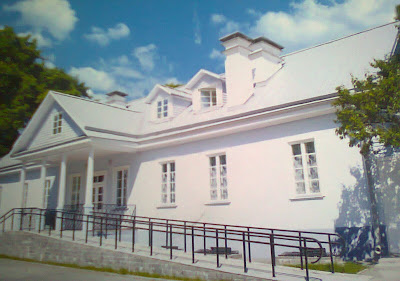
Welcome to the White House :)

However...it is not the white house you thought about :) I have got this card from Grodno - Belerus. Grodno is a city in Belarus. It is located on the Neman River, close to the borders of Poland (about 20 kilometers away) and Lithuania (about 30 km away). This city is the capital of Grodno Region and Grodno district.

On the postcard you can see the house, where Eliza Orzeszkowa (1841-1910) used to live. She was a Polish novelist, born in Belarus, to the noble Pawłowski family. In her sixteenth year she married Piotr Orzeszko, a Polish nobleman, who was exiled to Siberia after the January 1863 Uprising. 

Orzeszkowa wrote a series of powerful novels and sketches dealing with the social conditions of her country. Eli Makower (1875) describes the relations between the Jews and the Polish nobility, and Meir Ezofowicz (1878) the conflict between Jewish orthodoxy and modern liberalism. "On the Niemen" (1888), perhaps her best work, deals with the Polish aristocracy, and Lost Souls (1886) and Cham (1888) with rural life in Belarus. Her study on patriotism and cosmopolitanism appeared in 1880.

A uniform edition of her works was published in Warsaw between 1884-1888. Much of her work is available in a German translation.

According to official records of the Nobel Prize committee, she was considered for a prize in 1905, to share it with Henryk Sienkiewicz, but only the latter ended up as laureate.

Only 283 km and need 11 days....not that bad ;) 

Isle of Man

Next card I have got from small island - Isle of Man.
The Isle of Man occupies a central position, not only in the Irish Sea, but also in the British Isles. The Island is some 52 kilometres long from north to south and 22 kilometres wide from east to west at the widest point. The coastline, which is over 160 kilometres long, encompasses an area of 572 square kilometres.

Despite its comparatively small size, the Island contains a wide variety of scenery. A range of hills stretches obliquely across the Island, the highest of which is Snaefell at 621 metres. Between these hills lie well defined valleys, which provide endless changes of scenery. Around the Island’s flat northern plain are long sandy beaches that contrast markedly with the rocky cliffs and sheltered bays around the rest of the coastline. Over two-thirds of the land mass is cultivated, principally the fertile northern and southern plains. It is said that the Isle of Man is like the whole of Britain in miniature and yet, with a population density of just 125 people per square kilometres there is room to breathe and grow.The capital town is Douglas, the seat of the Manx Government, and main centre of population. Other major settlements are Onchan, Ramsey, Peel, Port Erin, Castletown and Port St Mary.

This postcard was very fast. It needed only 5 days to made a huge distance. I would like to get every postcard  that quickly :D However....rather it is not possible:( But...always I can dream to have a faster postman :D 

Time to visit Spain

Cantabria is a Spanish historical region and autonomous community with Santander as its capital city. It is bordered on the east by the Basque Autonomous Community - province of Biscay, on the south by Castile and León (provinces of León, Palencia and Burgos), on the west by the Principality of Asturias, and on the north by the Cantabrian Sea (from here). 
With a surface of 5 300 square kilometers Cantabria offers extremely varied landscapes and climates. there are still bears, wolves and eagles in its mountain ranges, Picos de Europa and the natural preserve of Saja, and the rivers are full of salmons and trouts. Pico de tres Mares ("peak of the three seas") is a real curiosity: a drop of water that falls here may equally arrive to Atlantic Ocean, by Duero river, the Cantabric Sea, by Nansa river, or the Mediterranean Sea by Ebro river.
Ebro is a river in north-eastern part of Spain. The source is in the CantabrianMountains. Flows in a depression between the Pyrenees and the Iberian Mountains. In the lower reaches, flowing through the Catalonian mountains, creates a breakthrough. Flows into the Mediterranean Sea, creating a fast-growing delta.

In total contrast is the coast with beautiful bays and romantic fishing villages. In between you will find green valleys and hills.

The postcard came to me from other part of Europe, it needed 1 week to appeared here. Nice :)

Der Himmel

Here you can see...the sky above Berlin. "Der Himmel" on the sky mean "the heaven". 

Wooden shoes

This is postcard from Netherlands. As you can see, it showed shoes. However it is not normal shoes - it is traditional wooden shoes. 

In the past "klompen" manufactured from poplar tree and were worn by Dutch peasants. Today there are Dutch symbol. Wooden shoes are very interesting souvenir for tourists, but still exist possibility to see the farm guy with this kind of shoes when he drives on his tractor. 

Currently produce approx. 3 millions this shoes by year. There are warmer and more drier from the rubber shoes, so there are wear mostly in the countryside. Shoes, used by Dutch farmers for many years, only recently been approved by EU as shoes – cheap, robust and secure. 

If any one from The Netherlands will be read this - please can you tell me more about this wooden shoes? There are really comfortable or not?:) 

Le coq au Riesling

Alsace is one of the smallest regions of France. It is located on France’s eastern border and on the westbank of the upper Rhine adjacent to German and Switzerland.
The political, economic and cultural capital as well as largest city of Alsace is Strasbourg. Because that, Alsace is politically one of the most important regions in the European Union, because in this city you can find the seat of dozens of international organizations and bodies. It consists of two departments: the Haut-Rhin in the south and Bas-Rhin in the north.
On postcard, you can see a typical meal of this region – Le coq au Riesling (chicken in the sweet white wine from the Rhine valley). If you want to try this – give me a sign and I will give you receipt ;)

49th state of America

Alaska is a mysterious and untamed wildlife power. The impression which make her huge glacers, extensive tundra, majestic fjords, canyons, valleys, forests and lakes exceeding all expectations. 

My third cards came from the largest state – by area - in the United States. It is 49th state. This state is situated in the northwest extremity of the North American continent, with Canada to the east, the Arctic Ocean to the north, and the Pacific Ocean to the west and south, with Russia further west across the Bering Strait. Alaska is the least densely populated state of the U.S.
The picture is a winter and summer picture of a famous glacier - Mendenhall Glacier - near Juneau (Alaska’s capital). This is my first postcard from postcrossing on 3D. I hope I will have more :) 

UNESCO

Second card, which I have received  is from Speyer - a city of Rhineland-Palatinate on Germany
City this is located near Rhine. Founded by the Romans. It is one of the oldest city of Germany
The city is dominated by the Speyer Cathedral.  

The Speyer Cathedral was built by the emperors and designated as their last resting place as a symbol of their power. Construction began around 1030 under the Salic Emperor Conrad II and it was consecrated in 1061. Under Heinrich IV renovations and extensions were undertaken. The cathedral of Speyer is the first known structure to be built with a gallery which goes around the whole building. The system of arcatures added during these renovations was also a first in architectural history. 

The Speyer Cathedral was added, in 1981, to the UNESCO World Heritage list of culturally important sites.

Gift from Czech

My first postcard :)

I have got it on my birthday which was on May ;)

Untypically-shaped card showing coates of arms of the cities in Czech Republic  :)

Beginning :)

It is my first blog :) So...please be patient with my posts :)

As theme of this blog I have chosen something very interesting and this what makes me happy every time when I find it in my mailbox. I mean postcards :) I love them!

If you do not know what is a postcard I will tell you now:) A postcard is a rectangular piece of paper (cardboard) intended for writing and mailing without an envelope.


Every time when I will find it in my mailbox I will show it here - I do not want forget about them and I do not want keep them only on some box.


So...please take your sit and enjoy :)